


EUMETView is a visualization service that allows users to view EUMETSAT imagery in a more interactive way through an online map viewer.
This service is on free access at the following internet address : http://eumetview.eumetsat.int/mapviewer/
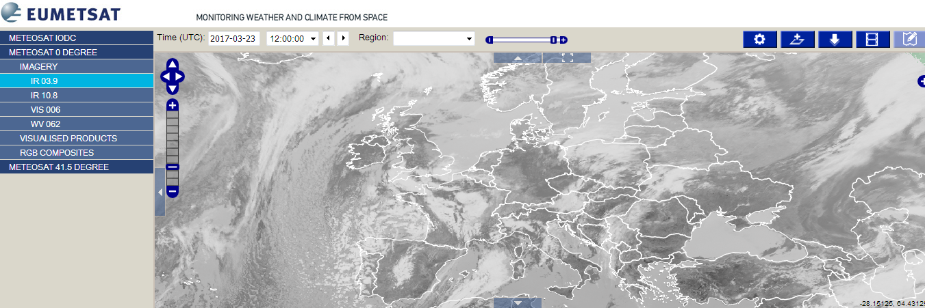
Photo 1: EUMETView software with a focus on Europe world region
Those displayed data came from different instruments from METEOSAT satellites as for instance :
- SEVIRI : 50 cm diameter aperture, line by line scanning radiometer, which provides image data in four Visible and Near InfraRed (VNIR) channels and eight InfraRed (IR) channels. The VNIR
channels include the High-Resolution Visible (HRV) channel.
Photo 2: SEVIRI instrument
- GERB : The Geostationary Earth Radiation Budget (GERB) instrument is a visible-infrared radiometer for Earth radiation budget studies. It makes accurate measurements of the short wave (SW) and long wave (LW) components of the radiation budget at the top of the atmosphere. GERB provides valuable data on reflected solar radiation and thermal radiation emitted by the Earth and atmosphere
After data processing activities they are use for Weather forecasting, numerical weather prediction, climate research and monitoring. This viewer allow you to have access to several weather forecasting products as :
- CLAI : CLoud Analysis Image
- CLM : Cloud Mask
- CTH : Cloud Top Height
- FIRE : Active fire monitoring
- MPE : Multi-sensor Precipitation Estimate
Source : http://www.eumetsat.int/ + http://eumetview.eumetsat.int/